Click here to read the summary of our recent SASMI Workshops!
South Atlantic Salt Marsh Initiative
A partnership to identify marsh conservation and strengthen communities in coastal Georgia.
The Georgia Conservancy, in partnership with the South Atlantic Salt Marsh Initiative (SASMI), is working to identify opportunities to protect and restore coastal marshland with historical, cultural, and/or spiritual significance to local communities.
SASMI’s goal is to ensure the long-term abundance, health, and resilience of the approximately 1 million acres of coastal marshland along the South Atlantic coastline. Protection and restoration of existing salt marshes and the conservation of land for marsh migration as sea levels rise will help us achieve this goal.
Why are coastal marshlands important?
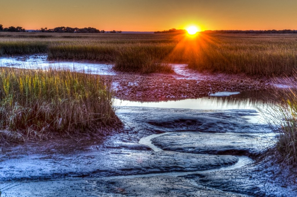
SAlt Marsh Sunset on Sapelo Island by The Georgia Conservancy
Salt marshes, and the estuaries that support them, provide shelter, food, and nursery grounds for many of our commercial and recreational fish species.
Salt marshes and coastal wetlands are some of our most important natural landscapes for sequestering and storing carbon.
Coastal marshland, and the oyster reefs that populate them, enhance the water quality in our estuaries by filtering polluted stormwater runoff.
During storms, salt marshes absorb flood waters and wave energy, protecting coastlines from flooding, erosion, and storm surges, and decreasing property damage.
Coastal marshland provides an important place for people to recreate and find solitude. Our salt marshes include sites of cultural significance and comprise an interconnected network of waterways for boating, fishing, and swimming.
Coastal Marshland and Marsh Migration
Our coastal marshlands are facing an existential threat from encroaching development and rising seas. As sea levels rise, salt marshes will face a “sink or swim” outcome - they will either drown and die off or they will migrate to higher ground, provided there are available lands and no barriers to their movement. Conservation of lands adjacent to the marsh and removal of barriers, such as culverts and bulkheads, will be key in allowing this natural marsh migration process to take place.
SASMI IN GEORGIA
Georgia boasts 368,000 acres of salt marsh (a sizeable portion of all the marshlands remaining on the eastern seaboard) across only 100 miles of coastline. Thanks to the Coastal Marshlands Protection Act, the existing marshlands in the state are protected from development threats, but there’s still much to be done to ensure that the existing and future marsh ecosystems stay healthy and intact. The Georgia Conservancy and Georgia SASMI Implementation Team are working to identify opportunities to restore and protect existing coastal marshland and to conserve areas for future marsh migration.
Examples of current SASMI Georgia Priority Projects
Blackshear Wetlands
Location: City of Savannah, Chatham County
This project envisions conserving 100 acres of freshwater tidal marsh, which will likely transition to saltwater marsh with 3 feet or more sea level rise. Humans have occupied the site since 500 AD starting with the presence of Native Americans. During the Truman Parkway's NEPA process, the remains of Indian shell middens were located and secured by a chain link fence. In the mid 1700s, enslaved people cultivated the rice fields and created the system of dykes still in evidence today. In the mid-1900s, this area became a dumping ground for industries along the Savannah River. In recent years, its primary purpose has been stormwater conveyance and storage.
Project Status: The City of Savannah has begun efforts to plan to preserve this area and create a passive recreational park open to the public. They have made initial contact with the private owners, who have indicated a willingness to negotiate the transfer of their property. The City has completed site visits with representatives from The Georgia Conservancy, The Georgia Department of Natural Resources, The US Fish and Wildlife Service, and The National Oceanic and Atmospheric Administration. All gave encouraging comments and stated the project would have wide support. The University of Georgia’s School of Landscape Architecture as well as Georgia Tech’s Urban Design Workshop have produced student concept plans for this area.
Martha Randolph Stevens Park Living Shoreline
Location: Unincorporated Liberty County, Seabrook Village
In 2021, the Seabrook Village Foundation began restoration efforts at the Park to preserve its history and reopen it to the community. However, after completing $60,000 of renovations to its community center, a site inspection revealed erosive currents and stormwater runoff created a dangerous cliff and destabilizing gully. The severe erosion to the banks of the tidal stream proved a threat to both the restored building and safe public enjoyment, and the Park was closed. Together, the Seabrook Village Foundation and Georgia Conservancy are working to preserve this cultural relic and restore waterway access for a vulnerable community by constructing a 400-foot oyster-based living shoreline and a bioretention area. The project will prevent erosion of the stream bank, restore oyster habitat, and eliminate structural threats to the community center caused by erosion.
Project status: This project has been identified as a high priority project as part of this stakeholder process and is urgently needed to prevent damage to the recently restored Community Center. Permitting agencies have already performed a preliminary site visit, and practitioners have evaluated nature-based solutions to address the erosion.
The Downtown Spine
Location City of St. Marys, Camden County
Downtown St. Marys routinely floods during significant tides and storms. There is a low-lying wetland area that has a waterway/canal running through its center (i.e. “the spine”) that has been altered through human activity. In addition, roads were constructed through this area, and the property has been parceled and sold. Since about 2014, the City has been working to acquire property in this area to prevent it from being developed, with the hopes that it could be improved to serve as a stormwater practice and a community amenity. Sea Level Rise modeling shows it will be inundated with minimal sea level rise. This project proposes to acquire the remaining private properties in the area and to upsize or remove roadway culverts to restore the wetland and floodplain capacity, eliminate barriers for aquatic species, restore habitat, and allow for future marsh migration.
Project Status: This project has been contemplated in several plans, and most recently was listed as the highest priority project in the NFWF-Funded Camden Resiliency Workplan. The USACE is currently developing a hydrologic model for this system, which could be used to design an engineered solution.
SASMI Project Identification SURVEY
Do you have a potential project idea? Do you know an area that needs protection or restoration? Is your property experiencing erosion? Please share with us and let us know! We are looking to continue gathering information about potential Salt Marsh conservation, protection, and restoration projects along the Georgia Coast.
Marsh Forward: The South Atlantic Salt Marsh Initiative
Questions? Please reach out to Courtney Reich at creich@georgiaconservancy.org or Luben Raytchev at lraytchev@georgiaconservancy.org


